August 15, 2016

Niagara By Bike

Aside from the 2014 Enbridge Ride to Conquer Cancer from Toronto to Niagara Falls, all my cycling trips were limited to one day. Thanks to the suggestion of a fellow cycling advocate (Helen), I rode the Greater Niagara Circle Route from July 15 to 17 with her and another friend.
The GO train did not have their bike cars on Friday evening; meaning exceeding the bike limits per train car was inevitable. With such high demand – a report called “Investigating Impacts of Cycle Tourism in Ontario” cited the Niagara Region was Ontario’s second most popular cycle tourism destination after Toronto[1] – GO Transit may want to address this. The Niagara trains are differentiated from Lakeshore West by only stopping at Exhibition, Port Credit (Mississauga), Oakville, and Burlington before continuing to St. Catharines and Niagara Falls. The trip took two hours and cost just under $40 round trip with a PRESTO card. The HI-Niagara Falls hostel we stayed at that night was near the train station and offered bike parking downstairs. To seal the night, we arrived just in time for fireworks at the falls.
Peace Bridge to Buffalo, New York
After breakfast on Saturday, we started the Circle Route with the obligatory stop at the falls. Bike lanes were available from the hostel to Rainbow Bridge. We then had to bike in mixed traffic – where drivers still gave us enough space unlike in Downtown Toronto – until just past the Horseshoe Falls where the Niagara River Recreational Trail started. Accessing the trail could use some wayfinding work. Along with some residential service roads, the trail provided a safe route to just before Fort Erie, where I had to stop at McCooey’s bike shop for some quick brake work. The trail resumes at the Peace Bridge to Buffalo, though we stayed on road to get a beverage at Tim’s.
Along the Friendship Trail
Along Lake Erie, the Friendship Trail provided views of Buffalo and its windmills until Helena Avenue, as well as a cool spot for a lunch break. From Helena, cyclists have to go the wrong way briefly; after which it’s a smooth, straight, and shaded shot to Port Colborne with no cars except at road crossings. Once at Port Colborne, some wayfinding improvements could be done to guide cyclists a short distance to the Welland Canal Trail entrance.
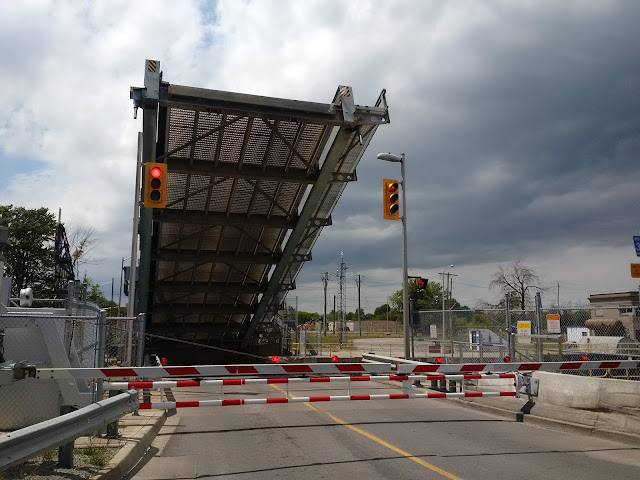
Lift bridge in operation at Port Colborne
The Welland Canal Trail provided two opportunities to see lift bridges in operation and boats crossing the canal (a.k.a. St. Lawrence Seaway). The first was at Port Colborne and the second on Sunday morning in St. Catharines. The trail goes by some industrial buildings such as a Robin Hood flour mill and rowing clubs. On the two occasions where the trail forks (at the mill and in Welland), go left both times. Aside from a small gap in Welland, this trail was mostly off road (but slightly rougher) until arriving at Thorold and St. Catharines for the night. Some air pumps were provided along the trail.
Brock University is your best bet for low cost lodging if travelling solo. The rooms were bog style (two people sharing a bathroom), decently furnished, and offered ring and post parking. Throw in $5 – 10 extra for breakfast – Tim’s and McDonald’s are nearby – and you are still paying considerably less than nearby bed and breakfasts, which are more appropriate if travelling with a partner or family. The university’s architecture has a modernist style and is isolated from Thorold and St. Catharines; requiring a 20 – 30 minute walk or 10 minute bike ride. In spite of this, stopping at Cab’s Caboose was worthwhile with their delicious chicken pot pie and reasonably priced craft beer.
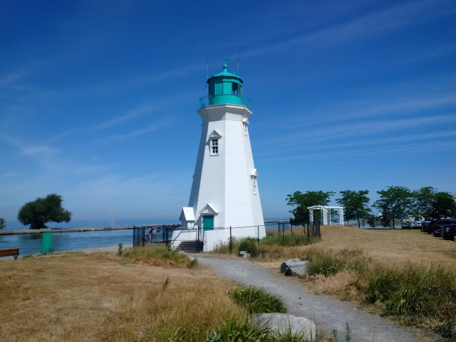
Lighthouse at Port Dalhousie
After reuniting with the group on Sunday morning, we started with a steep downhill on the Niagara Escarpment and detoured to Port Dalhousie with their pier, lighthouses, beach, and a carousel which still charges five cents per ride! Back on the trail – where a signal on the east side of the canal is needed given fast moving traffic – the road has paved shoulders and it is a feast for the senses! By bike, you could smell the peaches from the road and pull over easily to take pictures or grab a snack. One word of caution about being near Niagara-on-the-Lake we bypassed the town via East-West Line (thanks, Helen) is a simple meal like a sandwich can cost $16!
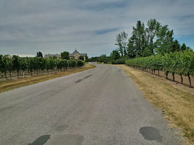
Peller Estate Winery was along our route
The Niagara River trail resumes at the end of East-West Line, along with a dreaded uphill climb to Queenston Heights. At the top, there was the Brock monument and some nice views over the Escarpment. We made one last stop at the Butterfly Conservatory gardens before returning to Niagara Falls. The trail ends at Whirlpool Park and bike lanes were used for the final approach to the VIA station. Three bike cars were provided for the return trip to Toronto, which do a reasonable job securing them in place.
Inside GO Transit's BikeTrain cars
Including Brock University and Port Dalhousie, approximately 160 kilometres were logged that weekend. For a one day Niagara bike trip, you could bike from Niagara Falls to St. Catharines via Niagara-on-the-Lake (40 – 45 kilometres) and board the train there. Finally, you can get more cycle tourism resources at www.ontariobybike.ca.

Tour on!
Rob Z (e-mail)


---

[1] Burns, H., McCulloch, M. & Dodds, R. (2015) “Investigating Impacts Of Cycle Tourism in Ontario”. TTRA Canada Conference. Niagara Falls, Canada, September 23-25, 2015. https://www.academia.edu/22349401/Investigating_Impacts_Of_Cycle_Tourism_On_Ontario

No comments:

Post a Comment